- Select the main menu.
- Select Map Setup.
- Select Map Information (you may have to press the MENU button again).
- Select the BlueChart entry and press ENTER.
- Scroll to each of the charts Im1(a), Ima, Ima1(A), Ima2(A), Ima23(A), Ru21085 then move the cursor over the checkbox to the left of the chart and press ENTER. Doing this should remove the check mark from the box, indicating that the chart has been disabled.
- When you press the QUIT or ESC button to go back up one menu level, you will see that the check mark in the box for the entire chart set is now removed. This does not mean that the entire chart set is disabled. It only means that one or more charts within the set is disabled. Selecting this box and pressing the ENTER button twice will re-enable all of the charts in the set, indicated by the check mark being in the box.

Garmin BlueChart v6
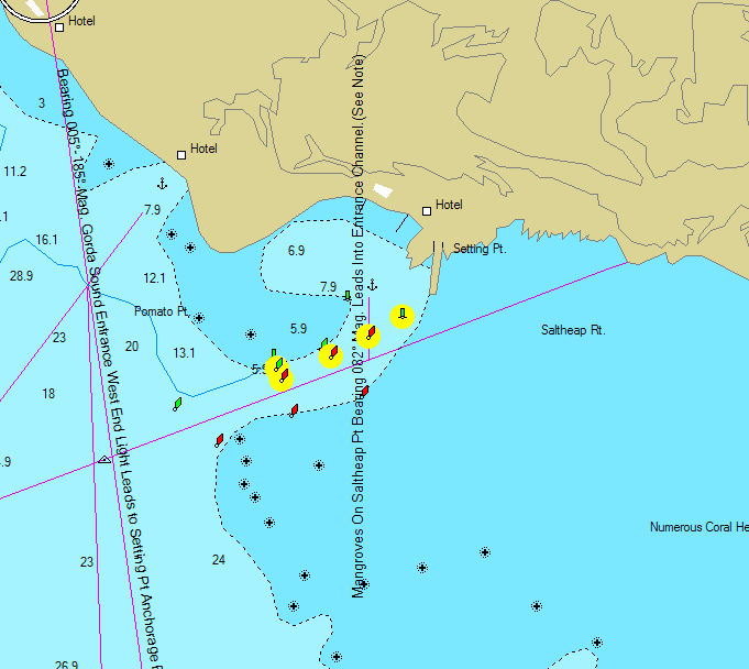
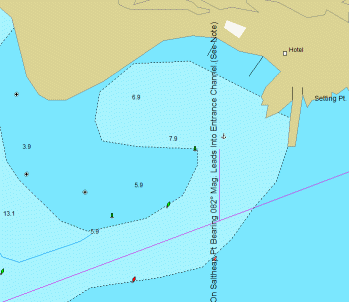
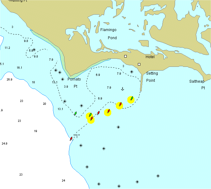
If you have Garmin BlueChart v6 electronic charts, then be aware that the Anegada entrance channel is charted incorrectly on the BlueChart. That segment of the BlueChart is derived from data on the Imray-Iolaire chart, which is out of date for its survey of the Anegada entrance channel. Below is snippet from the BlueChart as it should be showing the correct entrance channel markers.
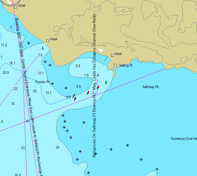
The Original BlueChart v6 is shown below, with the proper entrance channel markers superimposed and circled in yellow. Take serious note: the position shown between the anchor and the green inner buoy (northernmost green buoy) as charted on the BlueChart is actually at the shallowest spot in the Setting Point anchorage! The water at that position is only five feet deep.
The animation below shows the area on the BlueChart, with my Anegada Approach Chart superimposed over it. A light red circle will appear over the shallow spot.
Garmin BlueChart V4.01
If you have Garmin BlueChart V4.01 electronic charts, then be aware that the Anegada entrance channel is charted incorrectly on the BlueChart. That segment of the BlueChart is derived from data on British Admiralty chart #2008, which is out of date for its survey of the Anegada entrance channel. Below is snippet from the BlueChart as it should be showing the correct entrance channel markers.
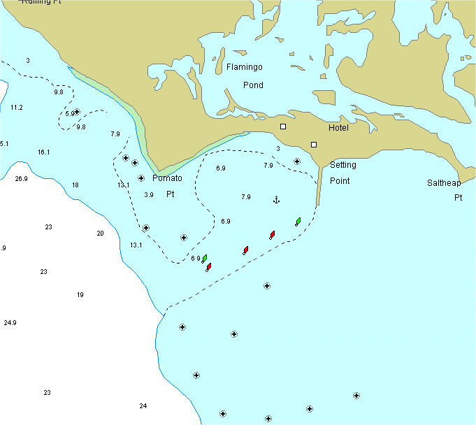
The Original BlueChart v4.01 is shown below, with the proper entrance channel markers superimposed and circled in yellow. Take serious note: the position shown for the anchor as charted on the BlueChart is actually at the shallowest spot in the Setting Point anchorage! The water at that position is only five feet deep. See the animation above.
| Important Notice to
Garmin BlueChart Users! Garmin BlueCharts include Russian chart Ru21085. Also, if you are using Garmin BlueChart version 6 or later, the charts include Don Street's Imray chart series. The charting of the Anegada area on some of these charts is incorrect by a substantial amount. Specifically, Russian chart Ru21085 and Imray charts Im1(a), Ima, Ima1(A), Ima2(A), and Ima23(A) are incorrect. All of these charts have the geographic features in the Anegada area approximately 1 mile to the northeast of their correct positions. When your GPS is zoomed to certain ranges, these charts may be selected for the display. If so, be aware that depth and geographic features relative to your position and waypoints will be shown incorrectly! Because of this, I strongly suggest that you disable these charts when in the Anegada area. When the charts are disabled, your GPS will simply select another of its charts that covers the area for that zoom range, and the depth and geographic features shown will be correct. The method for disabling individual charts varies from one Garmin GPS to another, but in general, it works like this: If you cannot disable these charts, then I suggest that you not download them at all to your GPS. |
![]()
![]()
![]()

![]()
NOTICE THE INFORMATION AND DATA ON THIS PAGE ARE PRESENTED FOR SUPPLEMENTARY REFERENCE ONLY, AND ARE NOT INTENDED AS A MEANS OF OR SUBSTITUTE FOR PROPER NAVIGATION AIDS. UNCHARTED AND UNMARKED HAZARDS EXIST. USE AT YOUR OWN RISK. DO NOT ATTEMPT PASSAGE TO ANEGADA WITHOUT APPROPRIATE CHARTS, BRIEFINGS, AND OTHER APPLICABLE INFORMATION. THE AUTHOR MAKES NO WARRANTY, EXPRESS OR IMPLIED, AS TO THE ACCURACY OR COMPLETENESS OF THE INFORMATION CONTAINED HEREIN. |
This page and the
contents thereof are the property of Walker Mangum
Copyright © 2002, 2006 by Walker Mangum
All rights reserved
Images on this page may not be reproduced without the express consent of Walker Mangum
You are welcome to create links to this page.