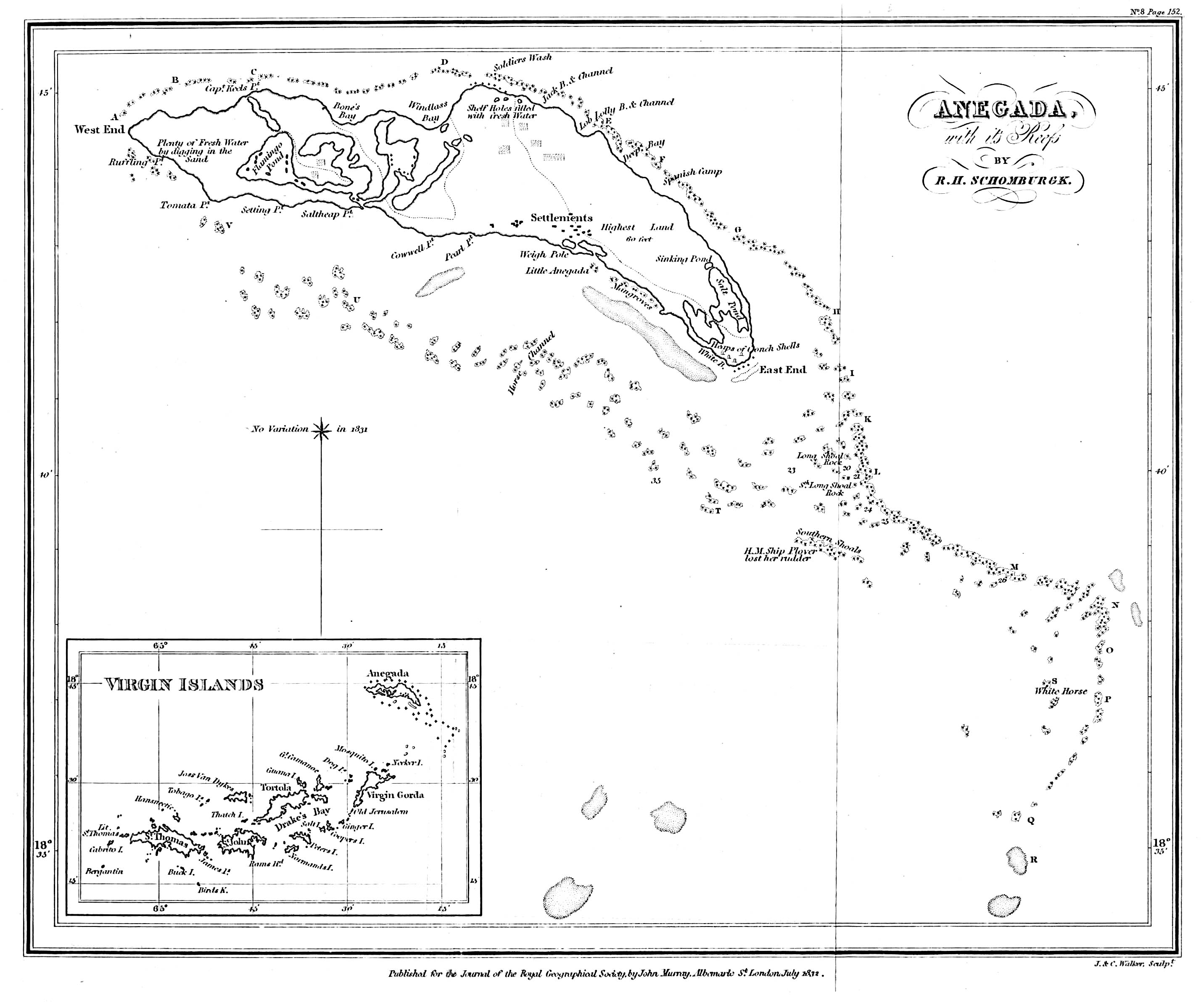
Robert Hermann Schomburgk, an
early British scientist in Guyana, made the first accurate chart of Anegada in 1831.
It is interesting to note that
most of the names of the landmarks that we know today were on this chart. The most notable
discrepancies are "Tomata Pt.", which we now call "Pomato Point",
"Cowwell Pt.", which we now call "Nutmeg Point", and the maximum
elevation, which is noted at 60 feet, probably due to survey error.
It is also noteworthy that, at
that time, the network of salt ponds came very close to stretching from the southern shore
all the way to the northern beach.
His remarks about Anegada were
published by the Royal Geographic Society in 1832. Images of
those remarks are here.
Click on the image below to
download a larger copy (2684x2387, 618kb)